The Saint's Way
The Saint's Way (Forth an Syns in Cornish) is a coast to coast walk across Cornwall, which runs for 42km (26 miles) from Padstow to Fowey
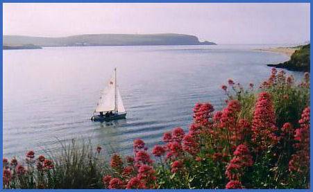
The trail follows what was the possible route of early Christian missionaries and pilgrims making their way from Ireland to the Continent. Rather than risk the perilous passage around Land's End they would disembark their ships on the North Cornish coast and progress to ports such as Fowey on foot. a number of religious sites which have connections with the Cornish Saints and Holy Men and parts of the route are of very ancient origin.The Saint's Way presents a fascinating walk through Cornwall's rich and varied history, passing megaliths dating from the Neolithic, Bronze and Iron Ages, medieval crosses and derelict tin mines from the eighteenth and nineteenth centuries.
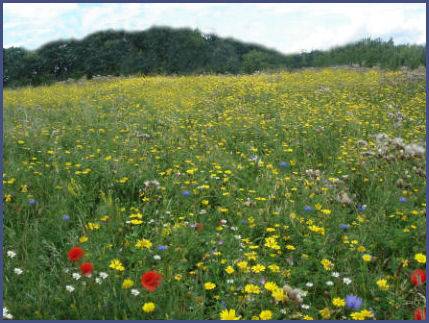
Starting at the busy harbour of Padstow on the North Coast, to join the trail, from the lych gate at Padstow church proceed along Hill street, then cross New Street and continue along Dennis Lane. Pass the boating lake and turn left at a footpath sign. The trail wends inland following the Camel Estuary before heading for the hills and uplands of Central Cornwall, the granite spine of the county. The trail follows a varied course through valleys, woodlands and villages crossing some of the most beautiful scenery in the county, inhabited by countless species of flora and fauna. The trail is waymarked with a Celtic Cross, but can get complicated at Helman Tor where there are two available routes to Fowey, one by Luxulyan, the other by Lanlivery.
Maps
Explorer maps 106, 107
Landranger maps 200, 204
Long Distance Footpaths and Walks