King Arthur's Hall
OS Grid ref:- SX 1296 7765
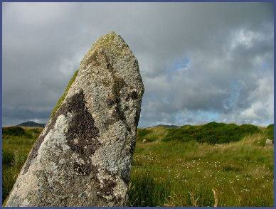 King Arthur's Hall is a prehistoric enclosure standing on an area of open moorland known as King Arthur's Downs. The monument consists of fifty-six stones forming a rectangular henge measuring around 48 metres by 20 metres.
The stones, which lean at precarious angles, originally stood upright to form a steep rectangular bank enclosing a marshy interior. The stones are of various heights and may originally have numbered as many as 140, the largest stone in the monument does not exceed 2 metres. It is bordered on the inside by vertical flat stones, which lend the appearance of chairs, which no doubt led to its name. There is an entrance to the monument through the bank in the south-west corner.
The hall has no connection to the legendary King Arthur, although archeologists are undecided regarding its purpose, it is believed to be either a ceremonial site, a mortuary enclosure or a prehistoric livestock corral. The monument is thought to date from the late Neolithic or early Bronze Age.
King Arthur's Hall can be reached be reached by a footpath east from the village of St.Breward. A good map is essential.
A walk from Bolventor to King Arthur's Hall
Distance 12 miles
*Commencing from Bolventor church proceed in a northeasterly direction along the road which runs parallel and alongside the A30 for around a hundred yards until reaching a footpath sign.
*Follow the footpath downhill to reach a pair of ponds, cross the footbridge and follow the footpath through a garden (which has public right of way). Continue along the path to cross a stile and enter a field. Cross the field to rejoin the footpath.
*Cross over a stile and onto a narrow lane leading to Priddacombe Down. At the end of the track cross a field exiting onto Priddacombe Down. Continue in a westerly direction towards the forestry plantation visible in the distance. On reaching the edge of the wood, proceed along the side of the wood for around a hundred yards before turning right and heading down towards a derelict farm to the east of Butter's Tor.
*Skirt around the base of Butter's Tor finding a permissive path and follow in the direction of Garrow Farm and Garrow Tor , crossing the De Lank River and follow the track up a steep incline to arrive at a disused farm. Proceed along the footpath leading from the farm entrance heading generally west, circling around Garrow Tor.
*Enter a small copse, cross a stile passing through the narrow copse and exit by means of a narrow bridge crossing a brook emerging onto open moorland. Ascend a hill, cross a stile then head west, passing various stone circles, a few hundred yards further will bring you to King Arthur's Hall.
*Retrace your steps to return to Bolventor
*Avoid walking on the moor if weather looks threatening.
*A compass is required for walking on the moor in case the mist descends.
*Carry light waterproof clothing.
*Wear headwear if walking in winter.
*Keep dogs under control, ponies, sheep and cattle graze on the moor.