King Doniert's Stone
OS Grid ref:- SX 236688
 King Doniert's Stone is situated one mile northwest of the small Bodmin village of St Cleer off the B3254.
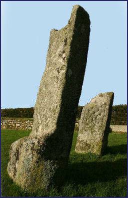
The Dark Age monument consists of two granite stones, the remains of crosses, which are carved with latin inscriptions and intricate patterns. They are associated with King Doniert or Durngarth, the last independent King of Cornwall who is reported in the Annales Cambriae to have drowned in the River Fowey in AD 875. One of the inscriptions reads ONIERT PROGAVIT PRO ANIMA, 'Doniert ordered (this) for his soul'. After Doniert's death Cornwall fell under Saxon control and eventually King Athelstan (circa 894 939), the grandson of Alfred the Great, united Cornwall with the rest of England, calling himself "Rex Totius Britannae", king of all Britain.
The Doniert Stone is the embellished pedestal for a large memorial cross and panelled on all four sides. It has a mortice cut into the top most probably to take a cross shaft and cross-head, is the only such cross to feature a character known also from documentary sources. Three sides of the stone are carved with interlaced patterns.
An underground rock-cut chamber commences as a passage around 8 metres to the south east of the crosses, turns into a tunnel and ends as a cruciform chamber beneath the crosses. The relationship between the underground chamber and the crosses is not known.
The stones stand in a small signposted enclosure on the B3254 road that runs from Minnions to Dobwalls, near the edge of Bodmin Moor. There is a small layby next to the enclosure. The stones stand only 12 miles from Hingston Down where in 838 the Anglo-Saxon King Edgar had defeated a combined force of Danes and Cornish, thus decisively bringing Cornwall under English control.
Controversy concerning the stones and others under the care of English Heritage arose in 1999. Members of the Revived Cornish Stannary Parliament, took down several signs bearing the English Heritage name. Since then a number smaller sites including The Hurlers Tregiffian Burial Chamber, St Breock Downs Monolith, King Doniert's Stone, Trethevy Quoit and Carn Euny have been transferred to the care of the Cornwall Heritage Trust, run by a bard of the Gorseth Kernow. The stones are known in Cornish as Men Myghtern Doniert.
Directions
1 mile north-west of St Cleer, off the B3254 road. Parking is on narrow roads, please park in adjacent lay-by.