St. Mabyn
OS Grid ref:- SX041732
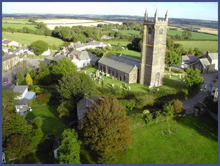 The characterful village of St. Mabyn known in Cornish- as Sen Mabon, is situated on the edge of Bodmin Moor, lying about 3 miles to the east of the town of Wadebridge.
The village's name derives from the sixth century St. Mabena (474 - 550), the daughter of the Welsh prince Brychan Brycheiniog, she was one of a reputed 24 children born to the prince.
The earliest signs of human habitation in the area are at the nearby Iron Age hill fort of Castle Killibury, otherwise known as Kelly Rounds. Radiocarbon dating gives a date of occupation between 400 and 100 BC.
The granite village church of St. Mabena is of fiteenth century origin and is a Grade I Listed Building. The present church occupies the site of an earlier one also dedicated to St. Mabyn.
A credence table which survives in the church may originally have been the panel of a tomb raised in Mabena's honour. It is possible that all her sisters had tombs erected for them.
The characterful village Inn, the St. Mabyn Inn, which formerly served as a farmhouse, has a friendly welcoming atmosphere and serves excellent meals.
The St. Mabyn Longstone was sadly broken up for gateposts in 1850, it was then relocated to a crossroad on the western edge of Bodmin Moor where it share a patch of ground with the Penwine Cross.
Castle Killibury
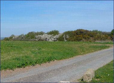
The nearby Iron Age fort of Castle Killibury, otherwise known as Kelly Rounds, dates to between 400 and 100B.C. The fort measures about 230 metres in diameter, is flanked by ramparts and ditches and has an entrance to the east.
Legend states it to be King Arthur's Court of Kelliwic. Excavations have revealed evidence of occupation of Castle Killibury from the Bronze Age through to the Iron Age, however, little has been unearthed here from the Arthurian period, except for two shards of Tintagel pottery. There is no evidence of refortification of Castle Killibury during that time period. Archeological interpretation is however difficult as the Castle Killibury area has seen extensive ploughed over the centuries, the stratiography of the soil has been destroyed and artifacts may possibly have been destroyed too.
The fort is situated beside the A39 road around two miles to the east of Wadebridge.